
Aboveground Biomass Focus Area Contributions to International Structures
GCOS
The Global Climate Observing System (GCOS) is an international organization charged with defining the observational requirements for Earth Climate Variables (ECVs). GCOS goal requirements for Biomass were set as follows (GCOS-245):
| Variable/Parameter | Horizontal Resolution | Temporal Resolution | Latency | Required Measurement Uncertainty | Stability |
|---|---|---|---|---|---|
| Aboveground Biomass | 10 m | 6 months | < 1 year | 10% | 5% |
Biomass Harmonization Dashboard
CEOS seeks to increase collaboration and transparency in the generation, intercomparison and validation of EO-based biomass estimates through the Biomass Harmonization activity. The goal is to facilitate the uptake of forest biomass maps by governments for policy reporting, for example, to the UNFCCC Global Stocktake. This objective is to be achieved by transparently intercomparing, validating, improving and easing the uptake of biomass maps by national governments. The activity has received a NASA Carbon Monitoring System (CMS) 2023 award to develop prototypes for national-level uptake, working with stakeholder countries of Mexico, Ecuador, Senegal and Ghana to achieve this goal.
The CEOS WGCV LPV Biomass Focus Area, in collaboration with the CEOS Land Surface Imaging - Virtual Constellation (LSI-VC) Forests & Biomass focus area, and others within CEOS contributing to the Agriculture, Forestry and Other Land Use (AFOLU) global stocktake, have launched a dashboard for the visualization of biomass products. This Biomass Earthdata Dashboard was created by the NASA-ESA Multi-mission Algorithm and Analysis Platform (MAAP) and the multiple biomass products are currently being analyzed through an open science Biomass Harmonization Activity that utilizes the MAAP. The MAAP project brings together data, algorithms and computation together in a cloud environment to address challenges of sharing and processing multiple data sources related to NASA and ESA missions, such as BIOMASS, NISAR, and GEDI.
CEOS Agency Biomass Missions
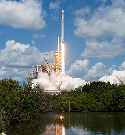
GEDI launch, December 5, 2018
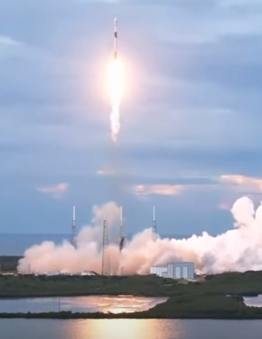
SAOCOM-1B Launch, Aug 30, 2020
Currently there are ten biomass-relevant missions expected to provide biomass estimations this decade. At right are images from two successful mission launches in 2018 and 2020.
The biomass focus area is engaged with the CEOS agencies involved with these missions and are also collaborating with other CEOS entities as well as NGOs in the development and refinement of biomass reference measurement site information. These collaborations and further protocol development will help maximize the utility of data, tools, and information for the benefit of all missions that contribute to our understanding of global biomass.
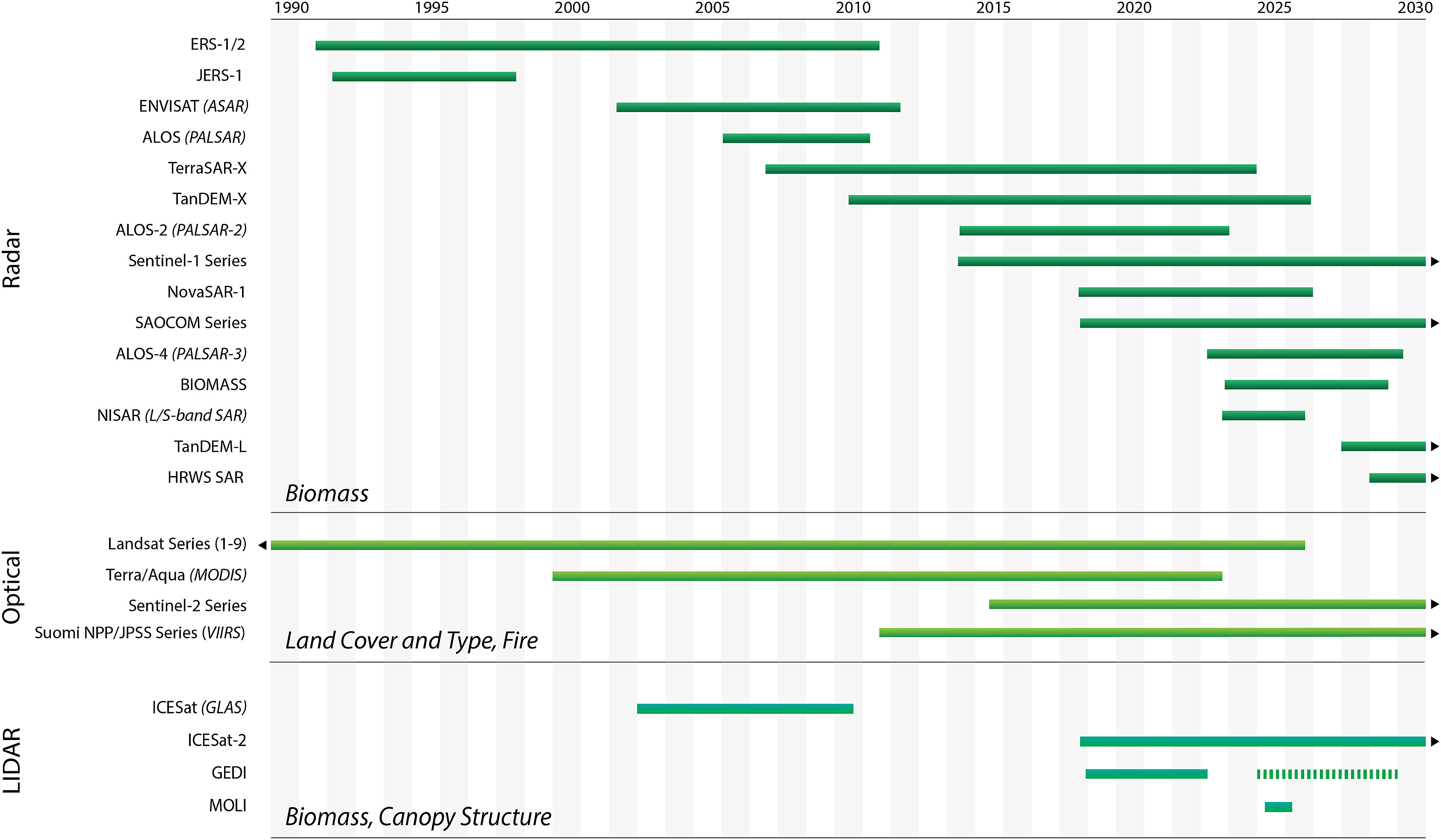
EO satellite sensors operating in different modes (optical, radar, thermal, and lidar) are currently in operation, providing information on forests and vegetation canopy structure, which enable the estimation of forest biomass. The graphic below is from Ochiai, et al., 2023, and shows the estimated lifespan of missions supporting global biomass mapping, sorted by Earth observation satellite sensor type.
SDCG for GFOI
The CEOS ad hoc Space Data Coordination Group (SDCG) for the Global Forest Observations Initiative (GFOI) was created to support the GFOI and forest carbon tracking. The biomass focus area collaborates with the SDCG and GFOI and together will promote the uptake of the forthcoming biomass protocol.
GEO-TREES
GEO-TREES: Forest Biomass Reference System from Tree-by-Tree Inventory Data. This is a community-led activity to support the ongoing collection of new high-quality biomass reference data and the distribution and sharing of these data, building on existing networks and partnerships. This project, initiated in January 2021, was borne out of the CEOS LPV Validation Protocol development effort, and has recently received a very large (12M USD) investment from the Bezos Earth Fund. The GEO-Trees efforts will be coordinated by the Smithsonian Tropical Research Institution.
